Autonavi releases DIY map feature, enabling the creation of personalized maps and self-driving itineraries
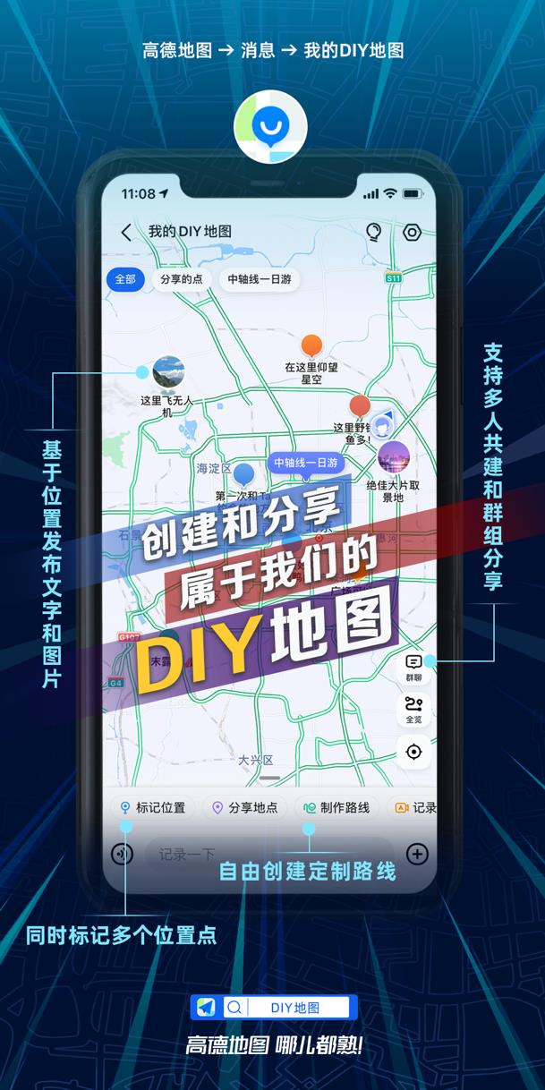
Everyone can create their own map! Autonavi recently launched a new feature of DIY map, which allows users to mark multiple locations, customize self-driving travel routes, and support multiple people to build and share with friends. DIY map is a re-interpretation of Autonavi’s new brand value proposition "Autonavi map, familiar everywhere", which further meets the personalized map needs of sub-groups and specific scenes.

Focusing on map services for 19 years, Autonavi has now built a map covering the national road network information and a large number of POI points of interest. But in many scenarios, what people need may not be a standardized map, but some specific places that carry their interests, work needs or precious memories. For example, honeymoon trips, self-driving tours, motorcycle runs, photography spots that can produce photos, drone release points, driver toilet maps, takeaway rider food delivery maps, etc.
"Using Autonavi’s proven mapping technology capabilities to provide a tool that allows everyone to easily mark places or routes and create a unique map, that’s what we designed DIY maps for," said Autonavi’s head of mapping related products.
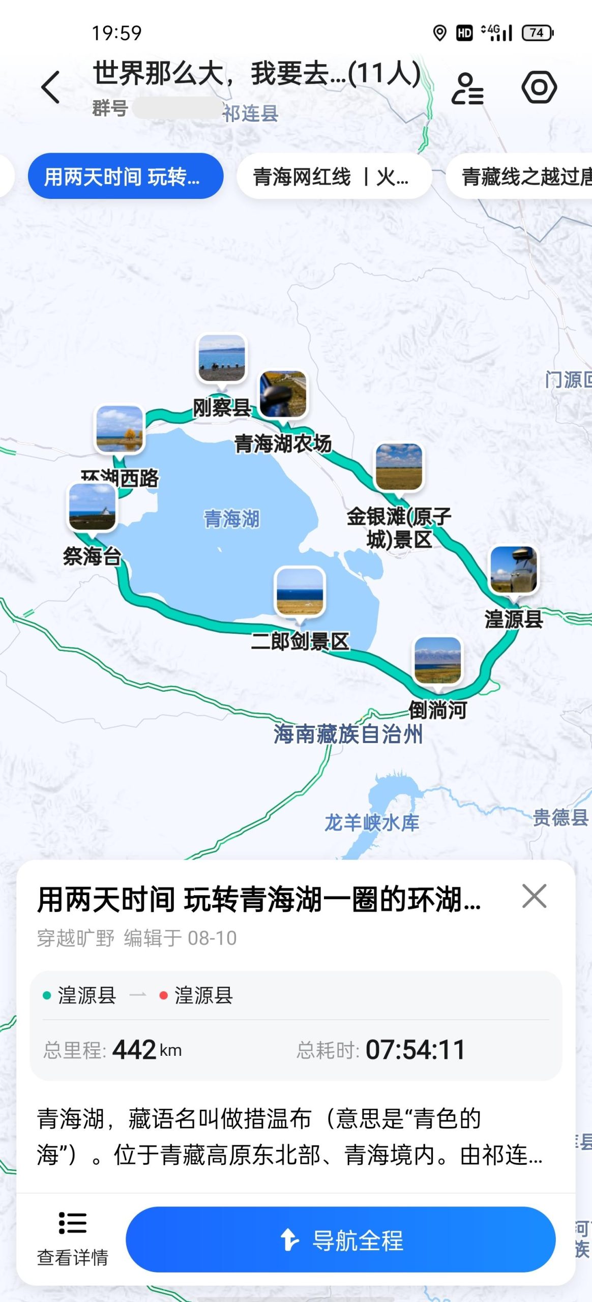
Now, users can use the latest version of Autonavi map and click on the "Messages" tab below to see the "My DIY Map" entrance. Click "Mark Location" to add any location in the map, and you can also fill in personalized names, descriptions, pictures and mark colors. Users who like self-driving tours click "Make Directions", and they can easily customize the tour route according to the guidance. After submitting, this information will be visually presented in the DIY map.

"Before, every time I organized a self-driving car, I was very tired. I always had to explain the route to friends who had never been there, and the communication cost was very high. Now that I have the Autonavi DIY map, I will send the planned route to the group in advance. Friends can directly see the route itinerary, route points, scenery photos and other information, which is very convenient."
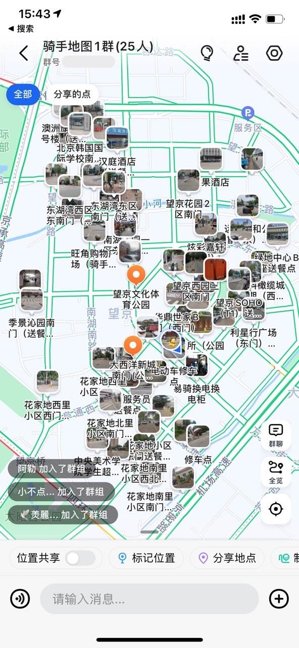
Mr. Pang is a delivery stationmaster of a takeaway platform, and he has encountered some difficulties in managing new riders. "In the early days of the station, new riders always encounter the problem of not being able to find the building number, and many times they get bad reviews because of this. Later, I learned that you can use the Autonavi DIY map to mark the uncommon building number, so I took the rider to make a delivery map near Wangjing. There is a building number, and it will also mark the entrance and exit of the community and the repair point. Now our newcomers are no longer afraid of being unable to find a place for food delivery!"

Maps and location are one of the most frequently used internet services. With the popularization and deepening of digital life, people’s needs continue to expand. To this end, Autonavi Maps has continued to strengthen product technology innovation in recent years. It is the first company in the world to launch lane-level navigation services on mobile phones. It is the only company that supports both AR driving navigation and AR walking navigation. It has innovatively launched traffic live and DIY maps, which continue to enhance the professionalism of map services and the breadth of people covered.